Guelph is famous for its rivers, specifically as the place where the Speed and Eramosa Rivers meet.
The two rivers are celebrated for their foundational role in the history and growth of the city but a number of tributary creeks contributed to the city’s development as well.
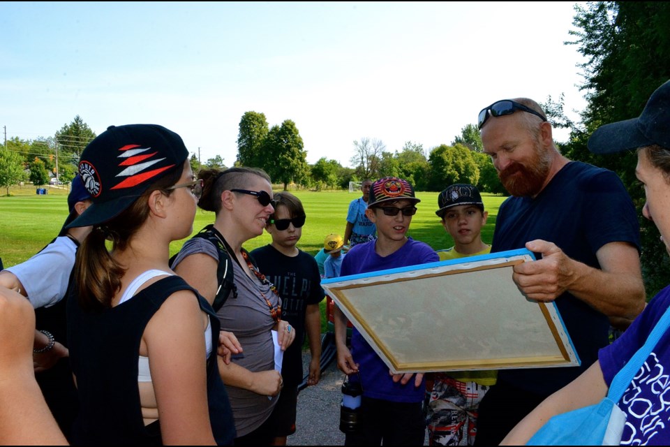
Their stories were all but buried in history until Guelph musician, environmental consultant and community planner Jeremy Shute started mapping them and taking people on tours.
“We are going to go into the bottom of Pond Creek,” said Shute last Friday morning as he led a group of kids from the River Walkers day camp into a tunnel at the edge of Silvercreek Park. “It is a creek that flows from Woodlawn Road and cuts through the corner of Exhibition Park and through the GCVI school yard. Another tributary comes up through St Joseph’s long-term care facility then it flows down through the city underground and comes out at the soccer fields here in Silvercreek Park.”
Shute is a managing partner of Shared Value Solutions, a Guelph-based consulting firm that specializes in, among other things, resource management, land use and community planning. Shute and his family were in the news in 2017 when they embarked on a canoe trip from Guelph to the Atlantic Ocean.
The tour Friday was a little less ambitious but no less connected to Shute’s passion for history and researching our collective relationship with water.
“Pond Creek is a natural stream, an old stream that was here when people first came here,” said Shute. “I don’t know where the name comes from but it shows up on some of the old maps before it got buried. Because the creek is at the lowest part of the land they actually channel a lot of the storm water into it.”
Shute has been exploring Guelph’s underground waterways since he was a kid.
“I think I probably started in Grade 5,” he said. “A couple of us would go underneath and a couple others would go above ground. We had these long sticks and we would stick them up through the holes in the manhole covers. People above ground would see the stick sticking up and then they would go further to where the next one was sticking up. That was our way to sort of track ourselves.”
That led to a more sophisticated mapping process.
“I made a map of all the creeks and about 20 years ago I really started to dig into the mapping,” he said. “It’s really just because of my interest in the rivers and creeks in Guelph. I am really trying to understand how it all fits together and I make the map available to anyone that wants to use it.”
His research revealed a development trend influenced by the creek system.
“A lot of the schools in Guelph are built along creeks,” he said. “Waverly Drive, Lourdes, John F. Ross, GCVI and a bunch of other ones. Most of those creeks are buried. I think it is because a lot of the schools got built in the 60s and the 70s and that was sort of the leftover land. Cheap property that was a little bit wet. What else are we going to do with it?”
The creeks were used by breweries and to power mills and the wetlands that fed them were often used for landfill.
“I have a map that shows where there are known landfill sites along the rivers,” he said. “There are a whole series of them around Guelph because they were using the river valley as a dump.”
Shute said different stretches of the creeks were buried over time and the parts that have remained above ground are barely recognized as more than roadside ditches.
He said the tours are opportunities to show people, especially young people, about the impact modern living has on our water systems.
Fun and education were the reasons the River Walker kids joined the tour Friday.
“It’s a camp we have run for three years now and the whole premise of this particular week of camp is around water protection and getting to the know the waterways that are in our neighbourhood,” said Alisha Arnold from the Two Rivers Neighbourhood Group.
Lanterns or flashlights were essential because a short distance in the tunnel is in complete darkness punctuated with thin shafts of light piercing down through the small holes in the manhole covers. At one point during the walk Shute convinced everyone to turn off their lights and listen quietly to the muffled sounds of the busy streets above. He then brought out his trumpet and let the haunting notes echo in the darkness.
“I love it when the kids go down,” he said. “It is perfectly safe and the water doesn’t get any deeper than six inches. They get to feel the creek. It’s cold water running. It’s not sewer water.
The kids love that and they will remember it as a highlight of the summer.”


