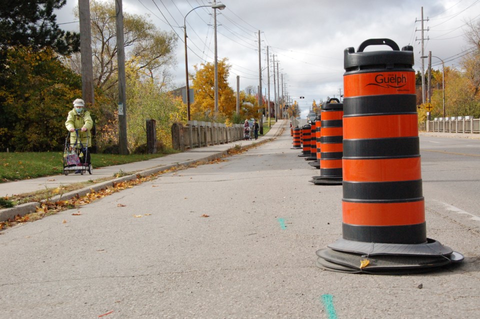
A lane closure along Speedvale Avenue, intended to aid physical distancing for pedestrians and cyclists, has seen a 175 per cent increase in those uses, states a city staff report.
In early June, the city closed one lane of traffic over the Speed River bridge, near Woolwich Street, which is considered a “pinch point” where physical distancing was otherwise problematic.
Since then, monitoring shows that area is “particularly well-used” with about 700 pedestrians and cyclists passing through each day, and a peak-hour use of about 90 people. That’s an increase of about 175 per cent compared to the same time last year, the report notes.
“The intervention on Speedvale will remain in place until winter maintenance is required, and the ‘narrow sidewalk ahead’ signs will remain in place until social distancing is no longer required,” states the report, released late Friday afternoon.
City officials also closed a lane of traffic along Eramosa Road, between Downtown Trail and Delhi Street. Monitoring there shows nearly 275 pedestrians and cyclists made use of that added space daily, with peak-hour usage of about 50 people.
The staff report, an update on pandemic-related impacts to the city, doesn’t provide a comparison to previous usage levels along that stretch of Eramosa Road.
The closed lane will be reopened at the end of this month due to lower anticipated use, as well as impacts on waste collection and street maintenance.
“Staff ... are using the data from that monitoring to inform recommendations for the future of these amenities,” the report states.
The city also created five one-way sidewalks throughout the city. Monitoring information for those locations wasn’t included in the report, nor was a timeline for change.
Those locations were chosen based on physical constraints such as guard rails, railings and retaining walls, and routes that serve grocery stores, hospitals and high-volume trail connections.