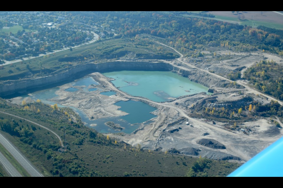
For just over 150 years, there has been a big hole on the west edge of Guelph.
When the Dolime Quarry began it would have been in the countryside, a fair distance from the town. The community’s historic limestone buildings — the churches, the downtown shops, the homes — would likely have used limestone from this quarry, one that has certainly left its mark on the architectural character, and the environmental landscape of Guelph.
In modern times, a dense residential neighbourhood has sprung along its southern border, where extensive remediation work took place to put a buffer zone between homes and pit operations.
The quarry is bordered to the east by the Hanlon Parkway, and by the Speed River curving around its north and west edges. Guelph’s waste water treatment facility is next door.
Many residents venture into the sprawling gravel pit portion of the property to hike and walk their dogs. While there is a high fence crowned with barbed wire around the south and east edges of the quarry, ‘No Trespassing’ signs are absent, and there is an opening at one section used by walkers.
The quarry, owned by River Valley Developments, and mined as Guelph Limestone by James Dick Construction Limited, has been the subject of much debate in recent years.
Of late, environmental activists and the City of Guelph have been quiet on the subject of Dolime, but it was a key local issue in the 2014 provincial election. All four local candidates favoured measures to protect Guelph’s water in the vicinity of the quarry.
It is well known that several years ago, extraction operations at the pit broke through the protective rock layer over an aquifer. Ever since then there have been concerns that a drinking water source nearby could potentially become contaminated by further digging.
From above, the Dolime quarry looks massive. A small part of its active section is only visible at ground-level from the interchange at Wellington Street West and the Hanlon Parkway.
The big hole is substantial, with water pooled over about two-thirds of it.
Wildlife tracks, particularly deer, are abundant through the property, and there are signs of new tree and shrubbery growth along and on top of old gravel mounds.
And there are signs of human recreation, with fire pits here and there.
This photo gallery features shots taken a safe distance from the edge of the pit.