NEWS RELEASE
GRAND RIVER CONSERVATION AUTHORITY
*************************
A warm front accompanied by heavy rainfall is forecast to move into the Grand River watershed on Monday and persist through Wednesday.
Temperatures associated with this weather system are forecast to reach upwards of 13 degrees based on current forecasts. Temperatures are not expected to decrease overnight during this event.
Rainfall totals of 40-50 mm are expected across the watershed. Rainfall is forecast to begin Monday morning and continue through Tuesday, with an additional 5-10 mm falling on Wednesday. The combination of warm temperatures and rainfall is expected to trigger significant runoff into the river system.
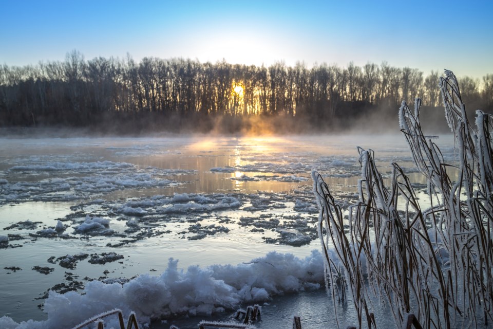
These conditions are expected to result in a total melt of the remaining snowpack and very high flows in rivers and streams across the watershed. T
his will result in flows similar to those experienced during normal spring flooding.
Ice jams currently in place in the Grand River through the City of Kitchener (Freeport), the City of Cambridge, City of Brantford and community of Cayuga have a high potential of causing additional flooding.
A small ice jam is also in place downstream of the community of Plattsville on the Nith River. It is anticipated that ice jams will release during this event. Ice jams can form and release without warning and extreme caution should be used in areas where they are occurring.
All GRCA reservoirs are at low winter holding levels and have storage available to manage runoff from this event which will help reduce downstream flooding.
Flood Warning: Action
Entire Watershed: Risk of flooding exists in low lying areas and from ice jams as this event moves through the watershed. Residents in areas near waterways should be aware of these conditions and take appropriate precautions.
Town of Grand Valley / Waldemar: The flood coordinator for Grand Valley / Waldemar should monitor conditions along the Grand River and prepare to close Hwy 25 and warn residents as needed. Current forecasts predict this area will begin flooding on Tuesday afternoon.
Township of Mapleton / Drayton: The flood coordinator for Mapleton Township should monitor conditions along the Conestogo River and warn residents in the Level 1 flood zone. Current forecasts predict this area will begin flooding on Tuesday afternoon.
Township of Woolwich / St. Jacobs: Flood coordinators in Woolwich Township are asked to monitor conditions and prepare to close the Three Bridges Road bridge, upstream of St. Jacobs on Monday afternoon.
City of Cambridge: City of Cambridge flood coordinators are asked to warn residents in the floodplain in the Blair area, adjacent to the Grand River, and the Speed River area downstream of the King Street bridge in Preston. This area could expect to experience flooding as a result of the ice jam beginning late Monday evening.
City of Cambridge flood coordinators are also asked to monitor and prepare to close Blackbridge Road at the Speed River on Monday evening.
Township of Wilmot – New Hamburg / Ayr: Township of Wilmot staff and Waterloo Regional police are asked to monitor conditions and warn residents up to the Level 2 flood zones in New Hamburg and Ayr. It anticipated that New Hamburg will begin to experience flooding late Tuesday afternoon. It is expected that Ayr will begin to experience flooding beginning late Wednesday afternoon.
City of Brantford: City of Brantford flood coordinators are asked to maintain the closure of Gilkison Street and monitor ice jam conditions closely through the dike reach. Ice jams currently in place are expected to release with this event. Flows are anticipated to peak through Brantford on Wednesday afternoon.
Town of Cayuga: Haldimand County flood coordinators are asked to warn residents in the floodplain in the Town of Cayuga in anticipation of ice jam flooding as a result of this event. Flows are expected to peak through Cayuga overnight Wednesday.
Town of Dunnville/Port Maitland: Haldimand County flood coordinators are asked to contact the Canadian Coast Guard to dispatch an icebreaker to the mouth of the Grand River in Port Maitland to reduce the potential for ice jams at this location. Flood coordinators should also warn residents in the floodplain. Flows are expected to peak on Thursday.
GRCA Ice Fishing
In anticipation of the incoming weather event, Belwood Lake reservoir, Shade’s Mills and Pinehurst Lake ice fishing operations will close at the end of the day on Sunday.
Stay Safe
The public is reminded to exercise extreme caution around all water bodies. Banks adjacent to rivers and creeks are very slippery at this time and, when combined with current weather conditions, pose a serious hazard. Parents are encouraged to keep their children and pets away from all watercourses and off frozen water bodies, which will be extremely unsafe as a result of the warming trend.
This message will remain in effect until 3:00 p.m. on Tuesday, February 20, 2018. Updated flood messages will be issued as conditions develop and better forecast information becomes available.
More information
- For more information on flows, weather and reservoir conditions see the River Datasection of the GRCA website.
- Safety information for parents and children is available in the GRCA’s River Safety Rulesbooklet.
- More information on the flood warning system is available on the GRCA website.
- Receive GRCA flood messages by e-mail by subscribing through the GRCA website.
- Follow GRCA flood messages on Twitter at grca_flood_msg.
- More information about how the GRCA manages floods is available in the Floodingsection of the website.