NEWS RELEASE
GRAND RIVER CONSERVATION AUTHORITY
**************************
The Grand River Conservation Authority is issuing the following Flood Warning message for the entire Grand River watershed. A significant winter storm is anticipated to impact much of the province through this weekend with precipitation beginning late Friday afternoon and persisting through Sunday morning.
There is still a great deal of uncertainty with respect to how much of this precipitation will fall as rain before transitioning to freezing rain as temperatures fall through the day on Saturday. It is expected that much of the northern Grand River watershed (north of Elora) will see a prolonged period of freezing rain, while the southern watershed (south of Cambridge) will receive heavy rainfall.
The central portion of the watershed (Cambridge to Elora) is expected to see a mix of heavy rain and freezing rain for much of this event. How this precipitation falls will greatly impact how local waterways respond. Northern Grand River Watershed In the northern portion of the watershed, runoff from this event is not expected to result in major flooding.
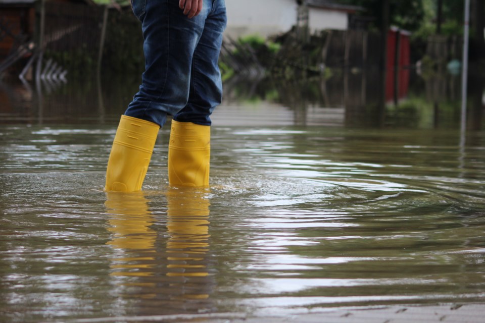
Flooding of low-lying areas adjacent to the river is expected, but significant flooding in the communities of Drayton and Grand Valley is not anticipated. Flows through these communities are expected to peak late Saturday evening. Central Grand River Watershed Runoff from this event is expected to cause some flooding through the central portion of the watershed in the communities of West Montrose, St. Jacobs, New Hamburg, Ayr and Cambridge.
Peak flows in the central portion of the watershed are expected to occur through the day on Sunday. Conestogo River (St. Jacobs) Flows in the Conestogo River through St. Jacobs are expected to exceed the capacity of the low-level bridge (Three Bridges Road). Woolwich Township Flood Coordinators are requested to close the low-level bridge on Friday and maintain the closure through the weekend.
Grand River (West Montrose)
Flows in the Grand River through West Montrose are expected to reach Flood Warning Zone 1 early Sunday morning. Woolwich Township Flood Coordinators are requested to notify residents in this area and monitor conditions.
Speed River (Cambridge)
Flows in the Speed River through Cambridge are expected to cause flooding of Black Bridge Road, the trail under Highway 401, and Riverside Park. Cambridge Flood Coordinators are requested to monitor conditions in these areas and arrange closures as necessary.
Nith River (New Hamburg)
Flows in the Nith River through New Hamburg are expected to reach Flood Warning Zone 2 mid-day Sunday. Wilmot Township Flood Coordinators are requested to notify residents in affected areas and monitor conditions. Nith River (Ayr) Flows in the Nith River through Ayr are expected to reach Flood Warning Zone 2 early Monday morning. North Dumfries Flood Coordinators are requested to notify residents in affected areas and monitor conditions.
Southern Grand River Watershed
Communities along the Grand River through the southern watershed including Paris, Brantford, Caledonia, Cayuga, and Dunnville should anticipate flooding in low-lying areas that typically experience spring flooding. Flows in the southern Grand River watershed will peak late Sunday and through the day on Monday. Grand River (Brantford) Flows in the Grand River through Brantford are expected to overtop Gilkison Street. Brantford Flood Coordinators are requested to close this area and monitor conditions.
Entire Grand River Watershed
Due to uncertainty in current weather forecasts and significant precipitation in the forecast, conditions will be monitored closely through the weekend and updated flood messages will be issued as observed conditions occur. There is limited ice cover on rivers and streams at this time and the risk of ice jam flooding is considered low with this event. GRCA’s major reservoirs at Belwood, Conestogo, Guelph, Luther, Woolwich, Laurel, and Shade’s Mills will be used to manage runoff from this event and reduce flooding downstream of these reservoirs.
Stay Safe
The public is reminded to exercise extreme caution around all water bodies. Banks adjacent to rivers and creeks are very slippery at this time and, when combined with current weather conditions, pose a serious hazard. Parents are encouraged to keep their children and pets away from all watercourses.
************************